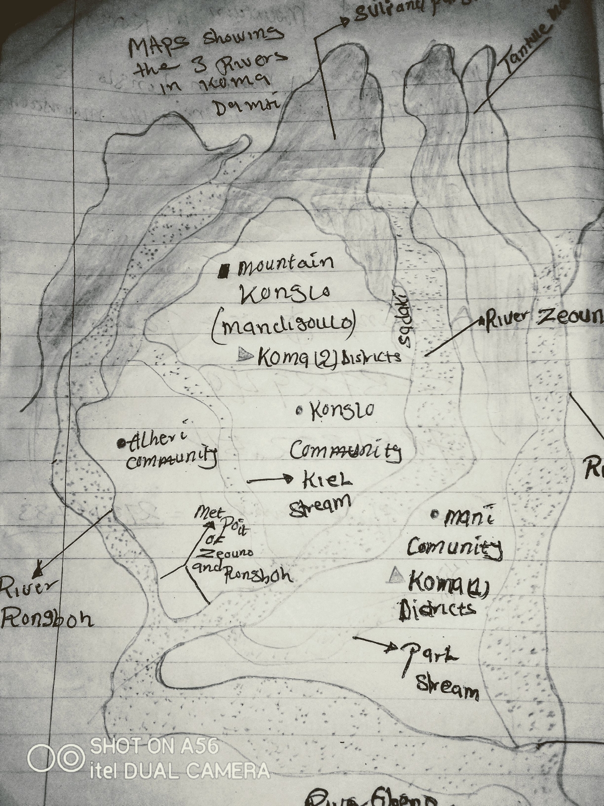
3 Most longest Rivers in Koma Damti.
The 3 Most longest Rivers in Koma Damti District of Jada local government area Adamawa north east; and their characteristics, position, and kilometers.
This Rivers drive and began their source from different mountains and hills; but met at the end point together into the river Gbeno of Cameroon republic in the north east; move through the district of Gurin fufore local government area of Nigeria, and empty into river Benue of Nigeria in the north west; the rivers contributed by streams in different desert communities in the land of Gbagi Koma Damti communities, but specifically joint river Gbeno to empty into river Benue in the north west of Nigeria; This Rivers are: Maps showing the 3 most longest Rivers in Koma Damti:
1 River Zeouno; River Zeouno is a river that drive from Pargi community of Suli Koma Maya of Jada local government area Adamawa north east; move through in-between Mani and Konglo community joint by Kiel and Parl stream and empty into river Rongbo in the north east of Koma Damti communities in the north by Beti community; This river is also a land boundary in-between Koma one and Koma 2.•Characterestics.
1. It's waters move with strong materials such as stones and trees.
2. It's carry water debris only in the raining season.
3. It's contributed waters from roads, streams, rice farms (mood land), gulf erosion, in the raining season, for strong movement.
4. It has desired habit to the houses, farms, Animals, near by or beside in the raining season.
5. It moves with Waters gallopings and moistures.
6. Is dangerous to both beings and Animals in the raining season, when not carefully crossing to the others side.
7.Its also a main boundary between Koma 2 District and Koma 1 District.
•Location:
River Zeouno was located between Mani and Konglo community in the south west of Koma Maya and Koma Damti communities; in the north east before contributing it waters into river Rongbo is bounded by Beti community of Koma vomni, and empty into the river Gbeno in Gurin fufore local government area Adamawa state.
•Kilometers:
River Zeouno his kilometers from it source to the met point with river Rongbo; 65 millions kilometers.
2.River Rongbo: River Rongbo is a second most longest River in Koma Damti community, after River Worla, and River Zeouno, river Rongbo drive it source from Gbagi community in Koma 2 District of Jada local government area Adamawa north east, move through in-between Wari and Alheri communities; joint with river Zeouno in the north east of Koma Damti and Koma Vomni communities, it's also a river that devided Koma Wari and Koma Vomni in the north east of Koma 2. •Characterestics:
River Rongbo perform some similar characters with river Zeouno, but different in source of origin and land location.
1. River Rongbo is from western Koma Damti.
2. some areas in the river as no water in the dry season.
•Location: River Rongbo is located in Wari Alheri communities of western Koma Damti Areas; it drive from Gbagi mountain, which is commonly known as Gbaropa, joint river Zeouno in the north east of Koma vomni, which is Beti community and empty into river Gbeno of Cameroon republic; River Rongbo has similar ansestors with river Zeouno; but different in kilometers.
•Kilometers:
River Rongbo his kilometers from the source to the met point with river Zeouno is about 75 millions kilometers, is a second longest River in Koma Damti communities after Worla river.
3.River Worla: River Worla is a most longest river in Koma Damti community that drive from Dolongi mountain, and move through in-between Tantule and Choncha community; and joint river Gbeno in Beti sigari community of fufore local government area Adamawa state, this is the only river that have direct connection with river Gbeno of Cameroon republic in the north east, without mething with others Rivers except streams.. Structure of River Worla
•Location: River Worla is located between Koma Damti south east, bounded with Mapeo District in the north east; in the east with chamber and vere communities; before empty into the river Gbeno of Cameroon republic in the north east of Nigeria; this river is land boundary in-between Koma Damti District and Mapeo District; is a first most longest river in Koma Damti community before river Rongbo and river Zeouno; all the three rivers began their source from Koma Damti and Koma Maya and met to empty into river Gbeno which drive from northern Cameroon republic and empty into river Benue in the north west of Nigeria.
•Characterestics
1. Fast and strong movement of water in the raining season.
2.Non water river in the dry season but only sands and stones which the waters carry down from mountain in the raining season.
3. Is identify as a long boundary in Koma Damti north east with chamber and vere communities, such as Mapeo and Karlahi District.
4. It's harmful and dangerous to both beings and Animals including properties in the raining season, if not carefully crossing.
5. Is a non board cross river because of it stubborn movement that contains stones and trees in the dry season;
6. Rise's of strong moistures that lead to cool weather in a dry season in-between novembre and December.
•Kilometers:
•River Worla its kilometers is about 185 millions kilometers, is a most longest river in Koma Damti communities; hawever river Zeouno is strong and large intimes of holding lakes, such as Ba'al-yari, Kuti-Kuti, and Kpam-kpami.Lake Ba'al-yari (Snake lake) Please follow Kajum b Samuel, or contact me, if you want to know more tori's center's in Northern Nigeria; most especially Adamawa north east. Thank you for reading this blog.


Comments
Post a Comment